Bright lights, no city
December 10, 2012 at 9:16 PM by Dr. Drang
A friend of mine has taken up the hobby of photographing the night sky. To get the kinds of images he wants, he needs to be away from the light pollution of the Chicago area, so when he has a business trip or vacation coming up, he consults various night sky maps that like-minded photographers and amateur astronomers use to locate the best places for viewing. If there’s an especially dark spot near his destination, he tries to schedule himself a side trip to go visit it with his camera and tripod.
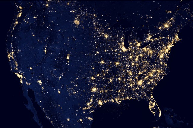
Today, he told me about these new images from NASA’s Suomi NPP satellite. There’s a nice animation built from snapshots of the entire Earth, but what fascinated me was this image of the United States.
(There’s a 6646×4430 available for download from NASA’s page.)
I’ve seen these kinds of photocollages before, and it’s always interesting to see the differences between east and west and how sharp the delineation is. A north-south line through Dallas separates two very different population patterns.
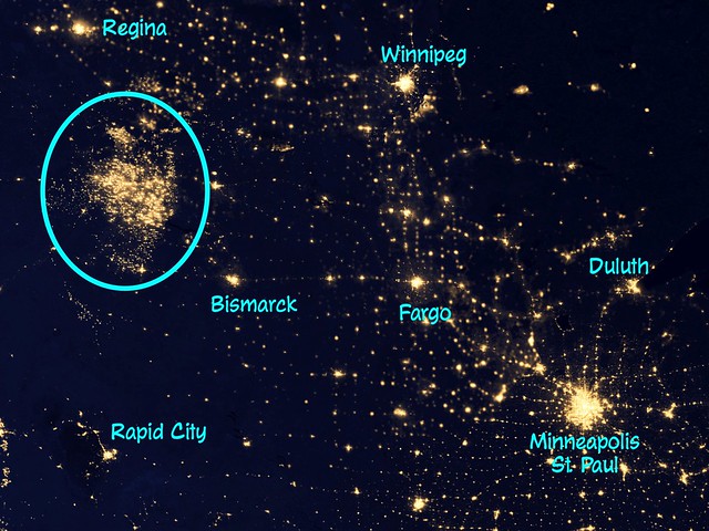
This image, though, had something I’d never noticed before. Look north and slightly east of Denver. See that big, somewhat diffuse patch of light? Here’s a zoomed-in view of that area with a few cities labeled to help you get your bearings.
Even if you didn’t know that this lit-up patch was in a generally empty area, covering western North Dakota and parts of eastern Montana and southern Saskatchewan, you could guess that it’s not a population center; despite its size, there’s no bright center to it.
The lights are from the oil shale fields spread out over the Williston Basin. It’s one thing to read about the boom in oil shale, it’s quite another to see such graphic evidence.


