Kayaking
August 12, 2025 at 9:08 PM by Dr. Drang
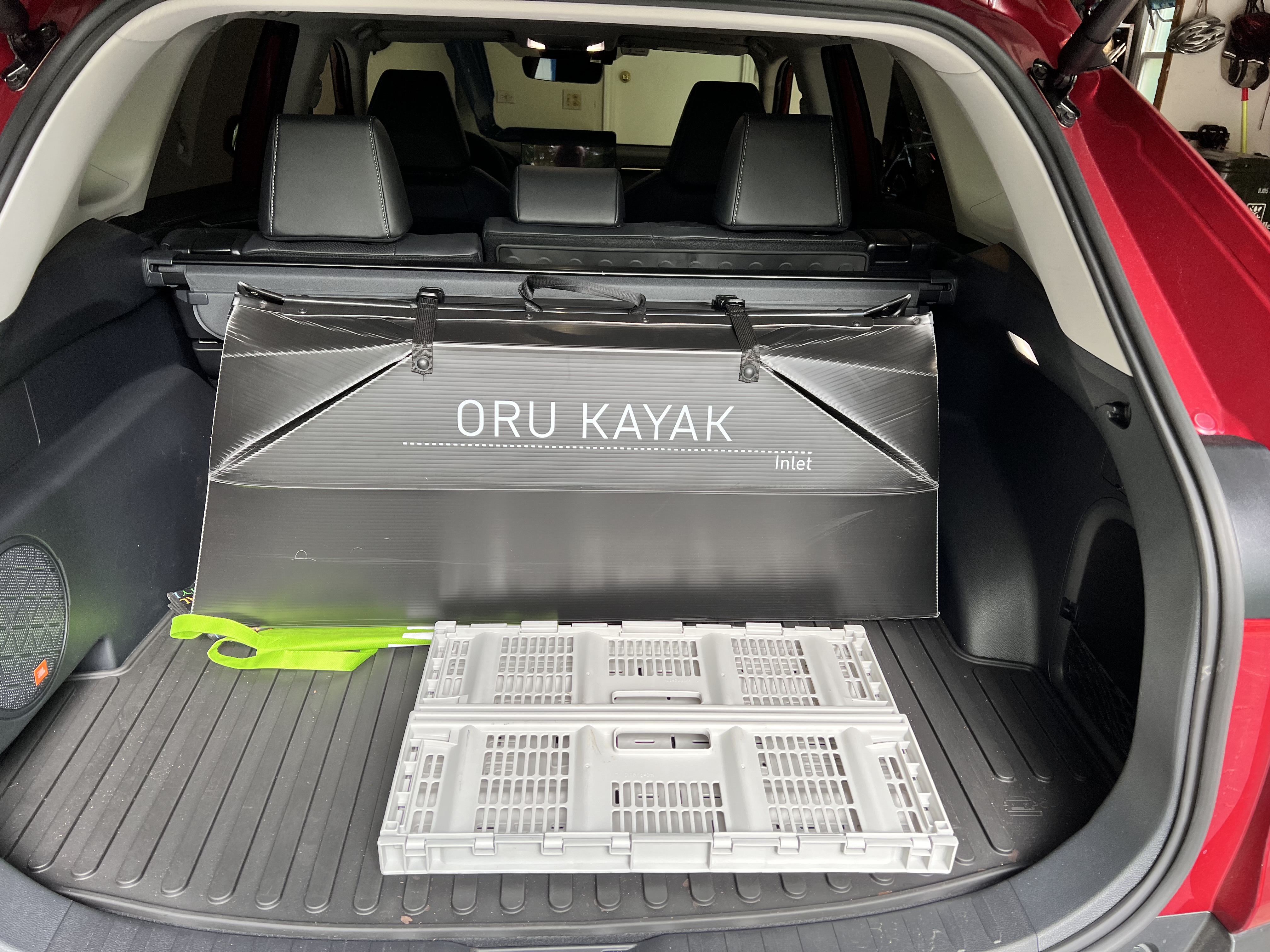
I was mentioned in the Snell Talk segment of yesterday’s episode of Upgrade. Jason was asked if he had a paddleboard, and he talked about how he’d like to have a kayak to go paddling in the bay near his home. The downside of owning a kayak is that you have to store and transport it, both of which can be a pain in the ass unless you have a foldup kayak. Like the Oru Inlet I have, which collapses down to the size of a large suitcase and fits neatly in the trunk of my RAV4.

As Jason said on the show, he’d probably need a kayak that’s a bit bigger and more stable than mine because of the choppier water he’d encounter in his bay. While I’ve been out on windy spring days when the waves were a foot high and had whitecaps—yes, even on the relatively small lakes around here—it’s unusual for me to see much chop.
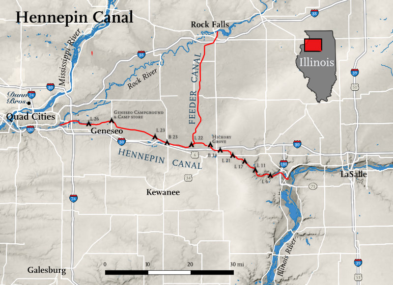
The segment reminded me that I’ve been meaning to write about a place I really enjoy paddling. It isn’t a small lake, it’s a 75-mile long canal. The Hennepin Canal connects the Illinois River to the Mississippi, running from Bureau Junction (just north of Hennepin) on its east end to the Quad Cities on its west end. It was built between 1890 and 1907.
Two things may stand out from that brief description. First, why is anyone building a canal from the Illinois to the Mississippi? After all, the Illinois feeds into the Mississippi—albeit at the southern tip of the state, hundreds of miles away. And second, isn’t the turn of the 20th century too late to be building a canal? We had railroads by then. Both of these are good points and help explain why the canal was never a real success. It limped along with much less traffic than planned until it was shut down by the Corps of Engineers in 1951. Twenty years later, it was turned over to the State of Illinois for recreation.
And for that, I’m grateful. Although it takes me about two hours to get to it, I’ve had a lot of fun paddling both east and west along much of its length from Lock 21 near Wyanet to Lock 24 at Geneseo.

Map drawn by Steve Spindler.
I just went last Friday, paddling for about 2½ hours,1 and seeing four or five blue herons, a couple of green herons and kingfishers, a few turtles, and one eagle. I’m pretty sure it was an eagle; it was too big to be a hawk.
I saw only one other person, a woman biking on the towpath. Did I mention the towpath that runs along the canal has been turned into a bike path? I typically see more people along the canal than in it. And I’m the only kayaker/canoeist I’ve ever seen. Fishermen in boats using trolling motors are fairly common, but I’m an anomaly.
There are a few aqueducts on the canal, where you paddle on a water bridge over a stream that passes underneath. And although there are highway bridges that pass over the canal, the more common way to paddle under a roadway is to go through a culvert.2 These are 12–15 feet in diameter and made of corrugated galvanized steel. I went through three of them on Friday; here’s one:
That was shot with a GoPro mounted on the bow. I didn’t have a GoPro the last time I went over an aqueduct, so I don’t have any movies of that. Next time.
I believe all the aqueducts are original. They carried barges over the streams a century ago just like they carry me. Most of the bridges and all of the culverts were built after the canal stopped having barge traffic.
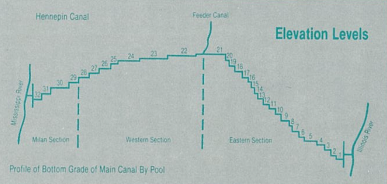
The locks are numbered from east to west, and there are a crapload of them in the eastern portion of the canal because the land rises steeply out of the Illinois River valley. Here’s the canal’s profile:

Now you can see why I paddle between Locks 21 and 24. There’s so little distance between the other locks, you can’t have a nice trip.
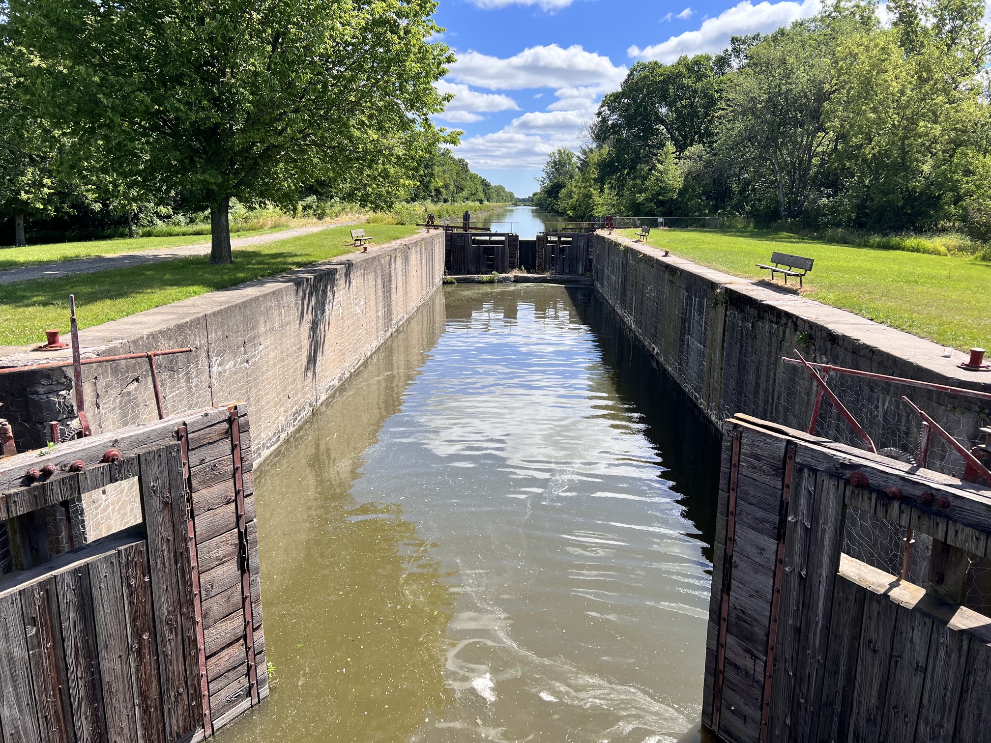
The locks themselves are fun to visit. All the ones I’ve seen have had little picnic areas nearby, and some have campgrounds. The locks don’t operate anymore, but you can still see a lot of the mechanisms and get a sense of the difference in water level between the sections. Here’s a view looking east along Lock 22; the water is a few feet higher on the other side of the far gate.

Because the canal is at its highest point between Locks 21 and 22, water has to come from somewhere to run west down to the Mississippi and east down to the Illinois. That’s the purpose of the feeder canal, which brings water down from the Rock River 29 miles to the north. It meets the main canal between Locks 21 and 22 at a place called Summit Pool. The locks insure that there isn’t much current in the main canal, but what little current there is runs west when you’re west of Summit Pool and runs east when you’re east of it.
Because I haven’t yet convinced my kayaking friends to take the long drive out to the Hennepin Canal, all of my trips on it have been of the there-and-back variety. I can’t go one way from lock to lock because I have to get back to the put-in place where my car is parked. I suppose I should look into whether there are any Uber or Lyft drivers out there.
