My 2024 Eclipse
April 9, 2024 at 7:47 PM by Dr. Drang
I drove down to Vincennes, Indiana, yesterday to see the eclipse, and everything was just about perfect—some through planning and some through serendipity. Here’s a brief review.
Vincennes was not my first choice. Using the eclipse path map at Time and Date, I looked for the shortest distance from Naperville, Illinois, to the path and figured I’d shoot for a rural area near Indianapolis.
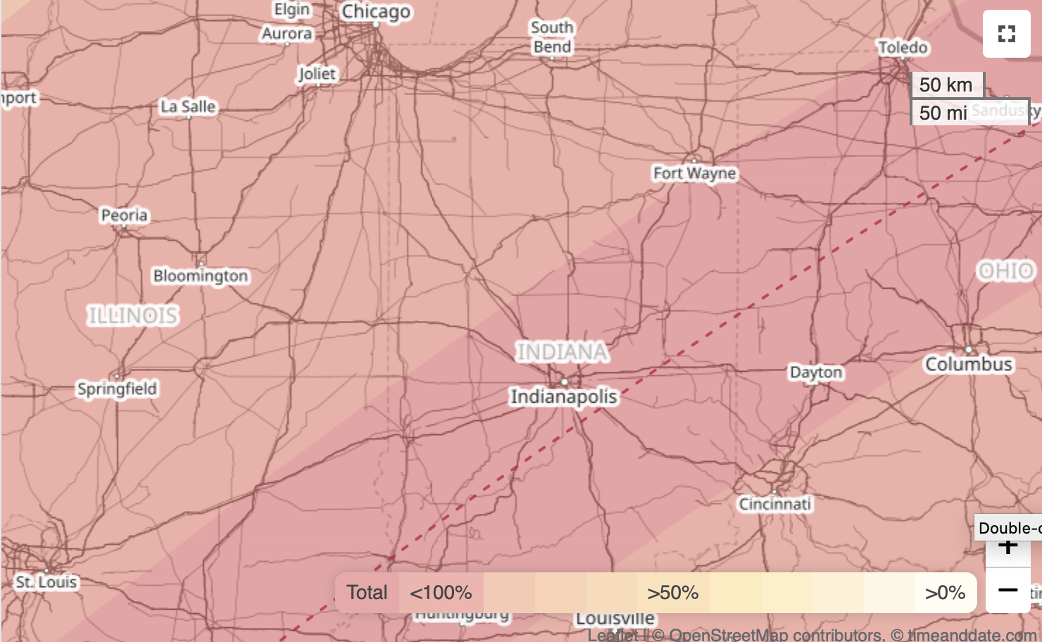
As Eclipse Day got closer, I began to have second thoughts. Two reasons:
- Traffic before and after the 2017 eclipse—which I saw with my wife and sons in southern Illinois—was a nightmare. Going near a decent-sized city ringed by a set of interstate highways seemed like a bad idea.
- Weather reports for the Indianapolis area were a little sketchy. Apple’s Weather app said it would be cloudy in the morning turning to partly cloudy by the time of the eclipse. “Partly cloudy” covers a wide range of cloud cover. Various weather websites also predicted partly cloudy skies, with less cloud cover as you moved southeast along the eclipse path.
So I started looking into Vincennes. It’s about an hour farther than Indianapolis under normal driving conditions, but I could get there via state and US highways instead of interstates, so I figured it was unlikely to attract as many people as the Indianapolis area. And it was supposedly less likely to have clouds.
Ultimately, it was a game-day decision. When I woke up on Monday morning and looked at the forecasts for Indianapolis and Vincennes, Vincennes seemed like it would have slightly better weather. And when I left, sometime between 5:30 and 6:00 in the morning, my route to Vincennes showed no delays. I didn’t truly trust the traffic because I wouldn’t expect people to be crowding the roads until I was two or three hours into my trip.
The drive went very well. I worked my way south and east to US 41 in Indiana (it became an hour later when I crossed the state line) and headed south. As I headed down through the land of windmills, Trump signs, and dollar stores, the traffic was light and the sun was bright. Somewhere—I think it was a bit north of Terre Haute—there was a billboard encouraging everyone to go to Vincennes for the eclipse, but there didn’t seem to be that many people following its directions.
I rolled into Vincennes around 11:30, desperate to use a bathroom. I stopped at a McDonalds and then felt obligated to eat there after using the facilities. Here’s where the serendipity struck. As I was eating (worst fries I’ve ever had at a McDonalds—remind me to tell you about the glorious fries I once had at Hamburger University), I started looking on my iPhone for a park nearby where I could kill some time before the eclipse, which wouldn’t get started for over two hours.
A website describing Kimmel Park on the north side of town, right along the Wabash River, said it had 1.8 miles of walkways. This appealed to me, as I’d missed my morning walk. For no particular reason, I opened the eclipse path page at Time and Date and zoomed in as far as I could. The centerline of the path went right through Kimmel Park.
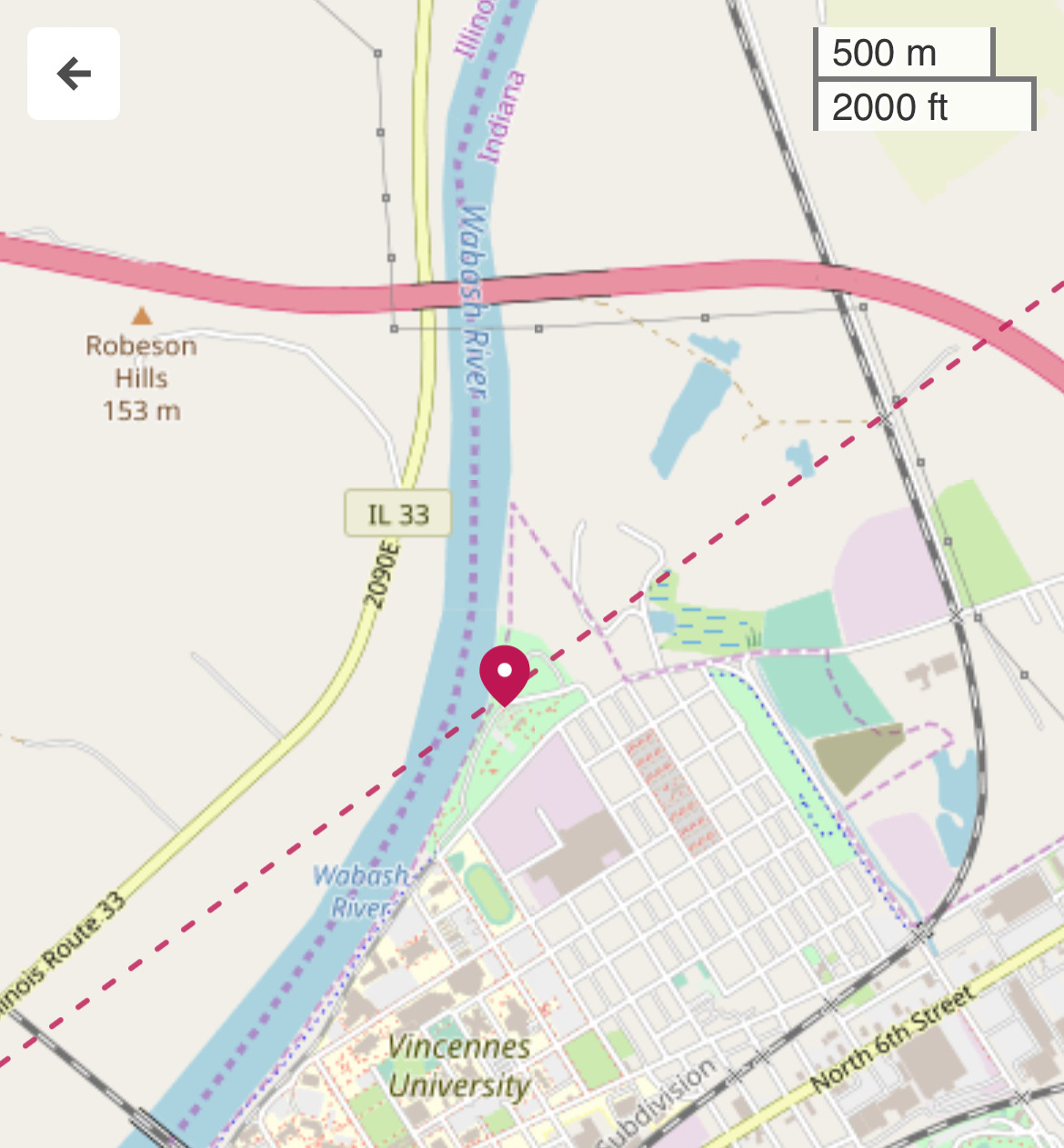
You see, I had not been planning to stay in Vincennes for the eclipse. It had looked to me as though the path went north of town (which it kind of does), so I was going to find a spot alongside a county road north and east of town, between Vincennes and Bruceville, for watching the eclipse. But now I had a better place, assuming the park wasn’t overrun with visitors.
It wasn’t. There were well-marked lots with free parking and mostly empty spots near the park. And while the park was far from empty, it wasn’t hard to find a place to settle in after I’d walked around it once. (While I’m sure the “1.8 miles of walkway” is accurate, that must be if you take every last branch, possibly doubling back on yourself.)
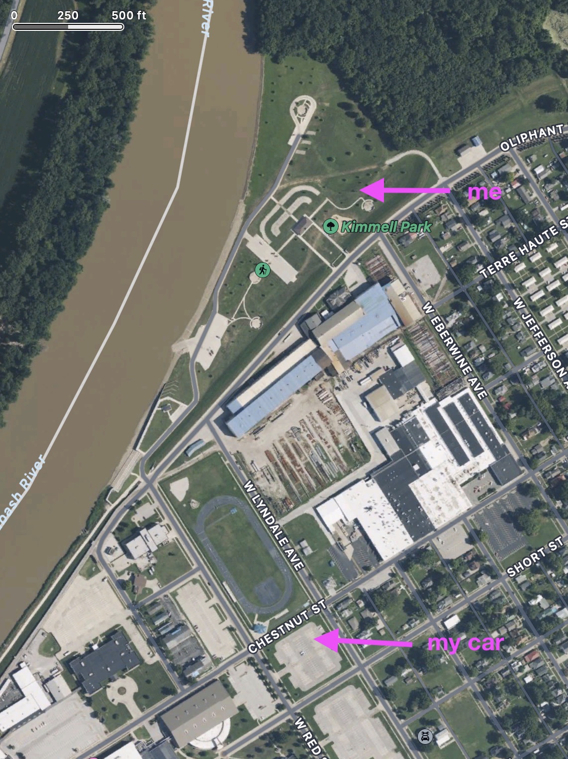
Here’s where I parked and where I sat for the eclipse.
I used the location data for a photo I took to mark the exact location.
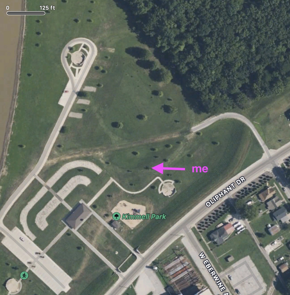
Honestly, I think I was at the next tree north and east of where my photo said I was, but I don’t want to argue with GPS.
How does this compare with the centerline of the eclipse path? This morning, I opened Mathematica and used its new SolarEclipse function to mark the path on map that’s more zoomed-in than I could get with Time and Date:
eclipse = SolarEclipse[DateObject[{2024, 4, 8}]];

GeoGraphics[{Red,
    SolarEclipse[eclipse, "ShadowAxisLine"],},
  GeoCenter -> GeoPosition[{38.69715, -87.51673}],
  GeoRange -> Quantity[250, "Meters"], GeoScaleBar -> "Feet",
  ImageSize -> Large]
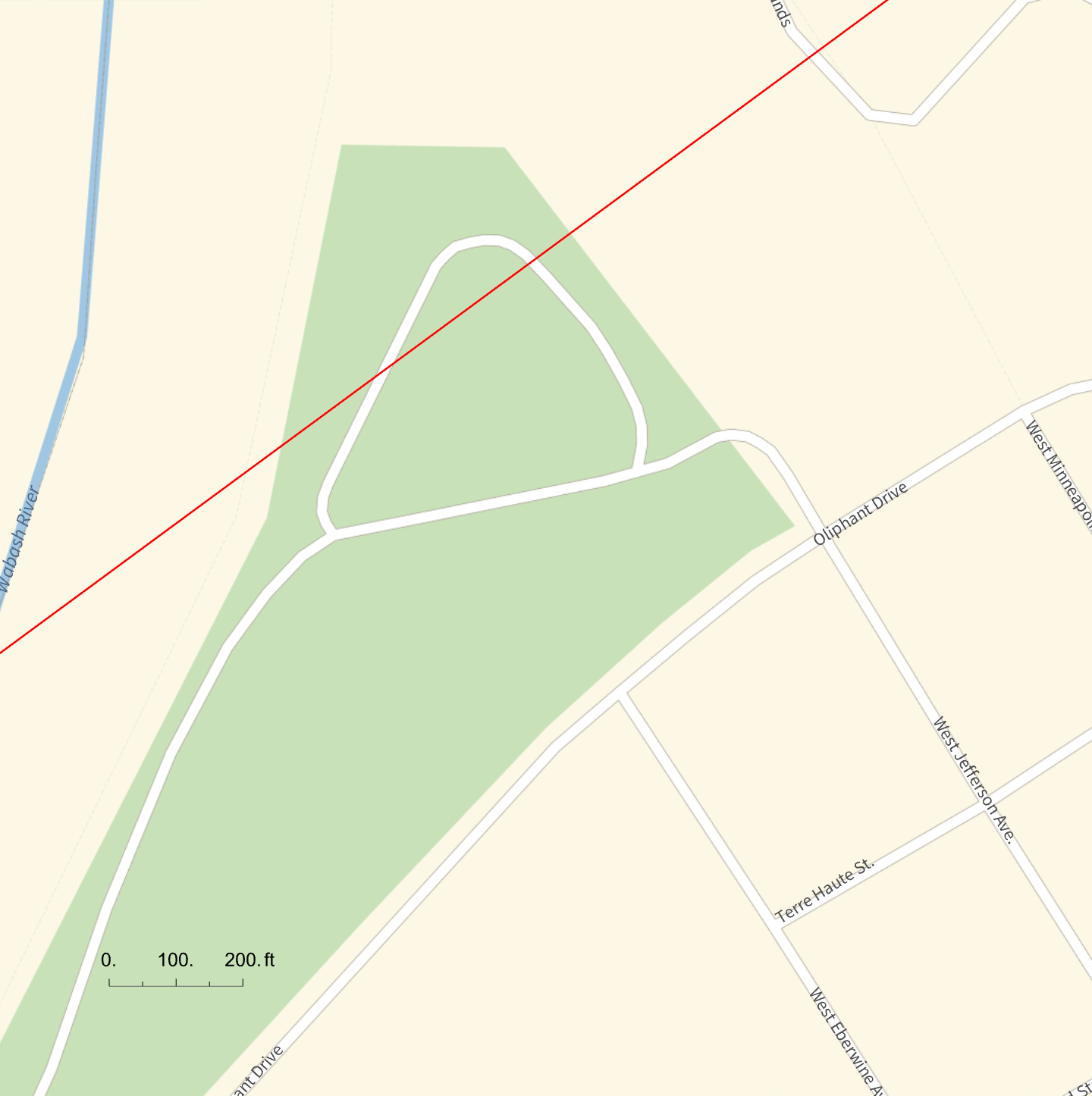
Apparently, the park district has changed the routing of the paved areas, but you can see that I was no more that 300–400 feet from the centerline. Recent rains had left the ground and some of the pavement wet by the peak of the triangle, and the shady areas near the treeline due north of me was already occupied. So I was satisfied with my spot.
There were some thin, wispy clouds, but it was obvious well before the eclipse started that the view would be fantastic. And it was. During the last 10–15 minutes or so before totality, I did nothing but look at the sun (through the glasses I’d kept from 2017), watching as the thin arc of sun got shorter until it disappeared entirely. I pulled off my glasses as a cheer went up and looked into the deep black of the moon surrounded by the white corona.
I did take a quick iPhone photo during totality, more as a reminder than anything else.
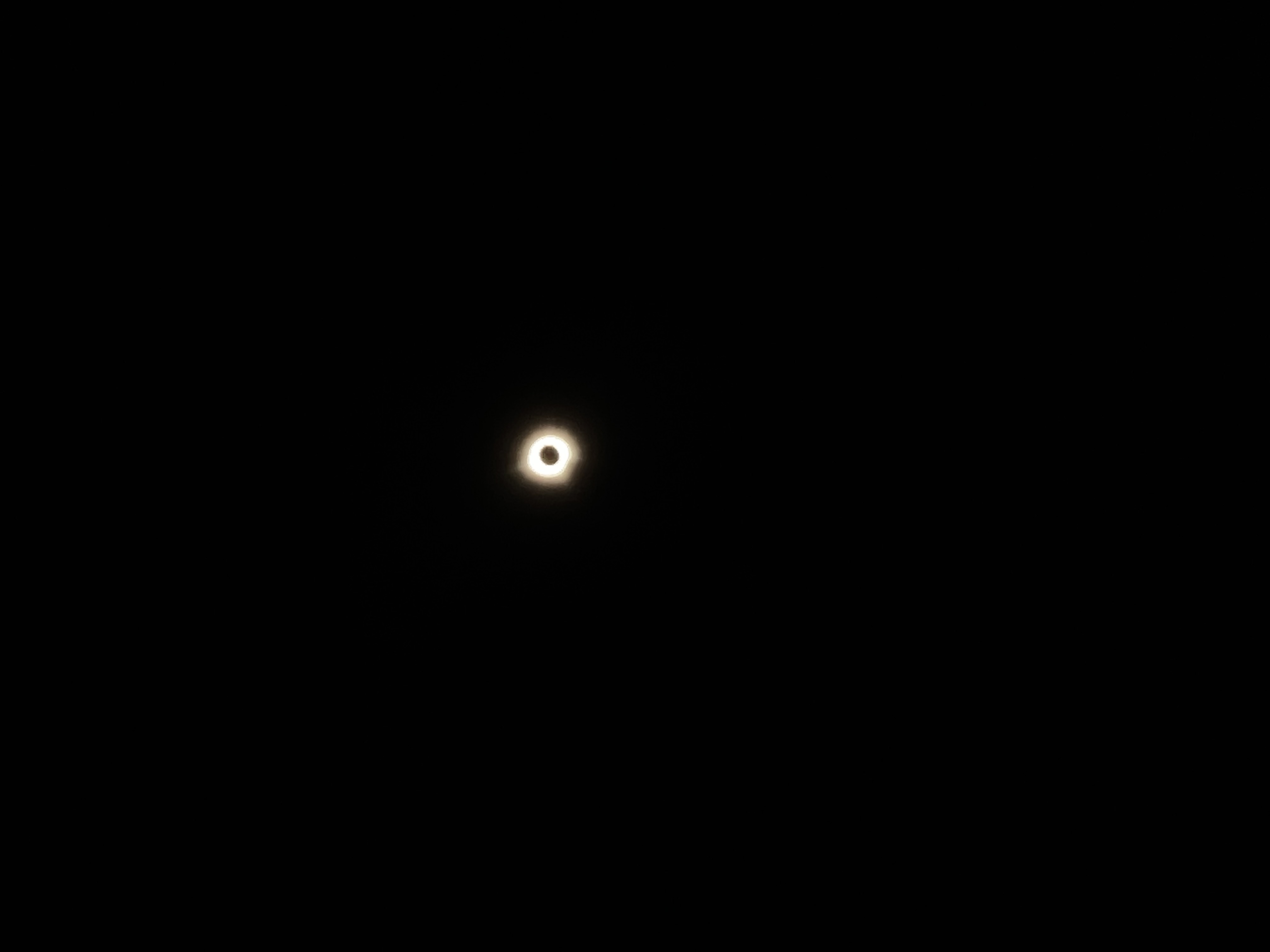
Patrick MaCarron—who was also in Vincennes, but I don’t know where—took a great photo of the eclipse, and you should follow the link to see it. It shows two red prominences: a large one near the bottom and a smaller one along the right edge. I saw the one near the bottom with my naked eye; it was a sharp red dot at the bottom of the black circle. I was unsure if I’d really seen it until I saw Patrick’s photo later on Mastodon.
I also found Jupiter (to the right) and Venus (to the left). I didn’t see Mars, Mercury, or that comet that was supposed to be at the edge of unaided visibility. This, I think, is where those wispy clouds came into play. I could see them around Jupiter, sort of how you see clouds on a moonlit night.
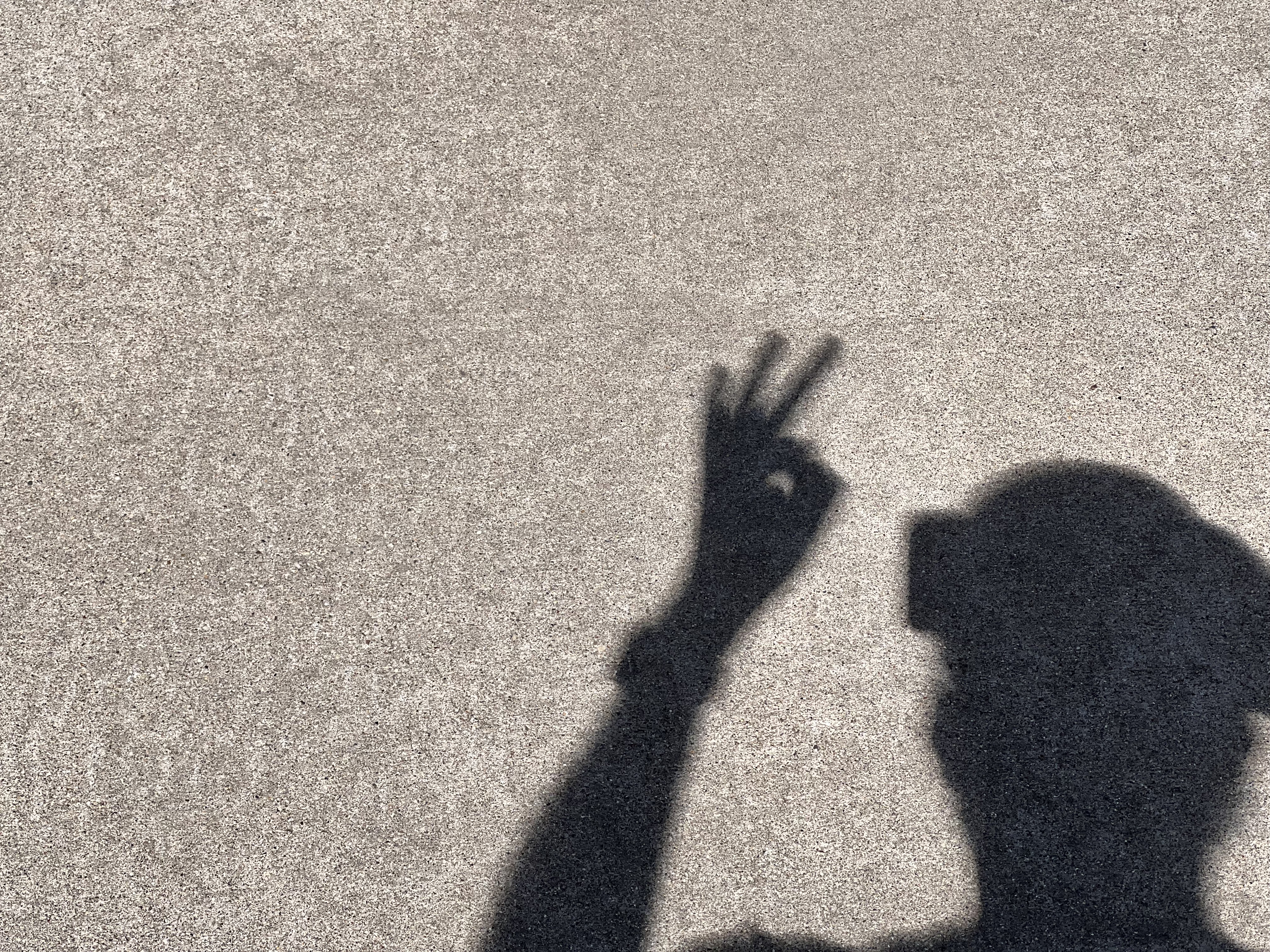
I hung around for a while after totality, but watching the Moon retreat isn’t as fun as watching it advance. As I walked back to the park entrance, I stopped to take photos of my shadow on the sidewalk. I made a sort of pinhole by squeezing tight an OK sign. You’ll have to zoom in to see the crescent coming through the small aperture.
Google Maps routed me through Champaign, Illinois, on my way home, so I ordered a Papa Del’s pizza when I was about an hour away and took it home for a late dinner. I got home just as the Men’s National Championship game was starting. I watched it while eating pizza—the perfect end to a perfect day.

